Processing Collapse Outpost: Uinta Mountains, Utah

At the heart of the Processing Collapse project is getting to know a forest through some aspect of its decline. Being startled into noticing prompts us to learn trees through the symptoms of their collapse. For years, we have been focused on the forests of eastern New York, where we live. Regular walks in nearby woods have taught us how to observe carefully and to identify regional species by their distinct characteristics. Occasionally we’ve made visits to forests outside of our main research area, but we rarely spend extended time with them.

Perhaps the most compelling forays have happened in Utah, where Michael grew up. These landscapes are familiar, but were never intimately understood. His past experiences in these forests were by no means superficial, but they were passive encounters made during moments of recreation or self-reflection. Returning to these forests today is a novel experience. With our new strategies for seeing, we can pick up on things we never would have noticed before.

Extending our work into a completely different terrain has become an exciting concept. We feel humbled and amazed looking at these ecosystems deeply for the first time, not knowing at all what to expect. This practice is also clarifying and refreshing: we return to our home forest with new questions and perspectives. Comparing and contrasting land use histories and the dynamics of tree species across the continent offers endless potential for discovery.

What follows is Michael’s reflection on his visit to the Uinta Mountains earlier this month. These emergent thoughts are inspiring us to seek an outpost for Processing Collapse in the West.


On October 11, I had the chance to spend a day touring the mountains in my mom’s car. This was by no means a pedestrian experience, but even so, it was stunning how quickly and easily I fell into observational reverie. I could picture projects unfolding as they do in our original research area.

Three things in particular caught my attention:

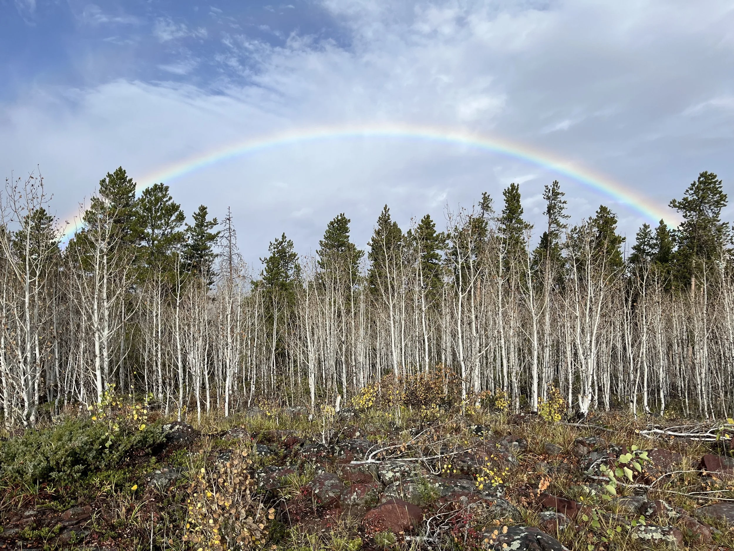
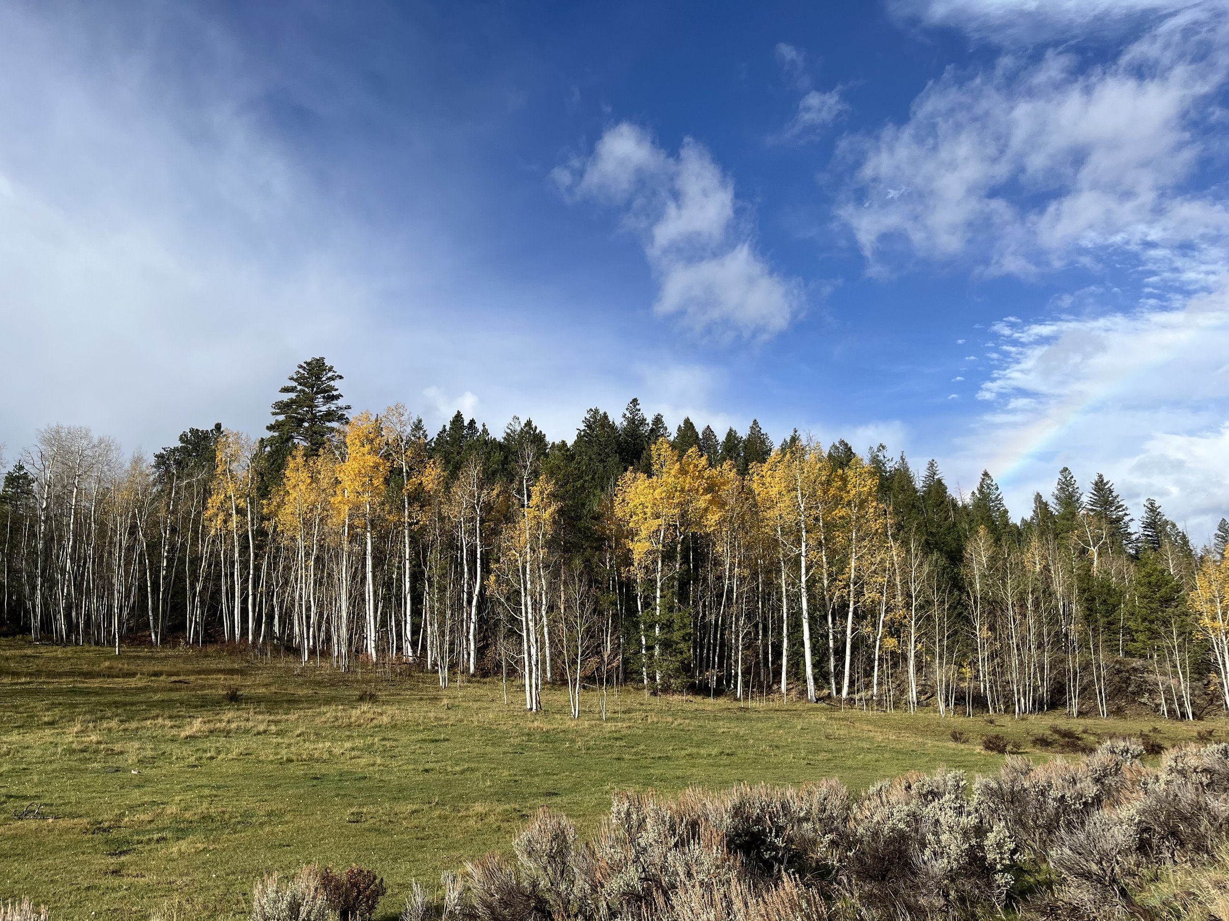
Quaking aspen stands out in high contrast in the fall mountain forest. This is one of few deciduous trees on the landscape, with changing foliage atop its stunning white bole. From the road they are easy to see.

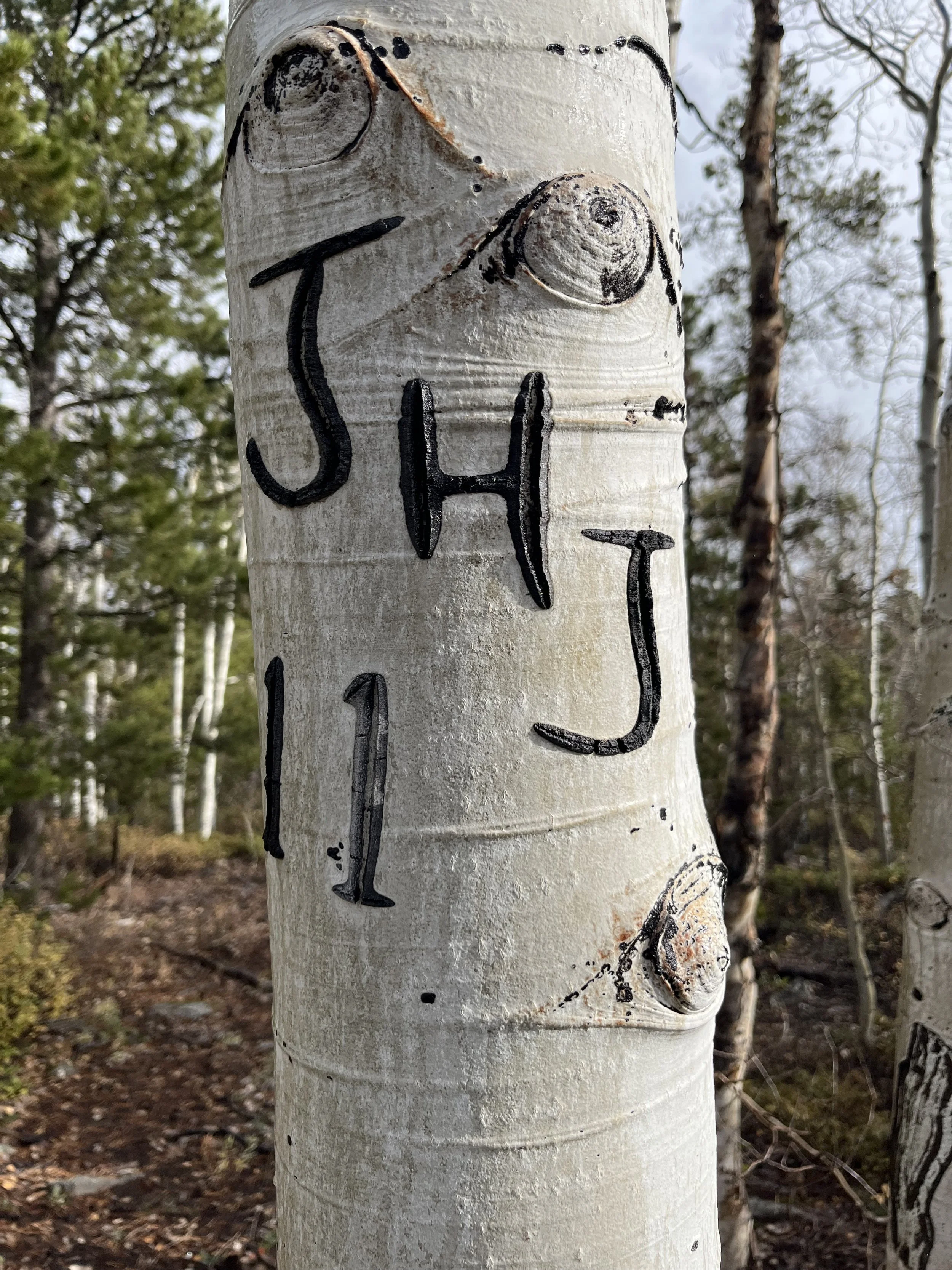
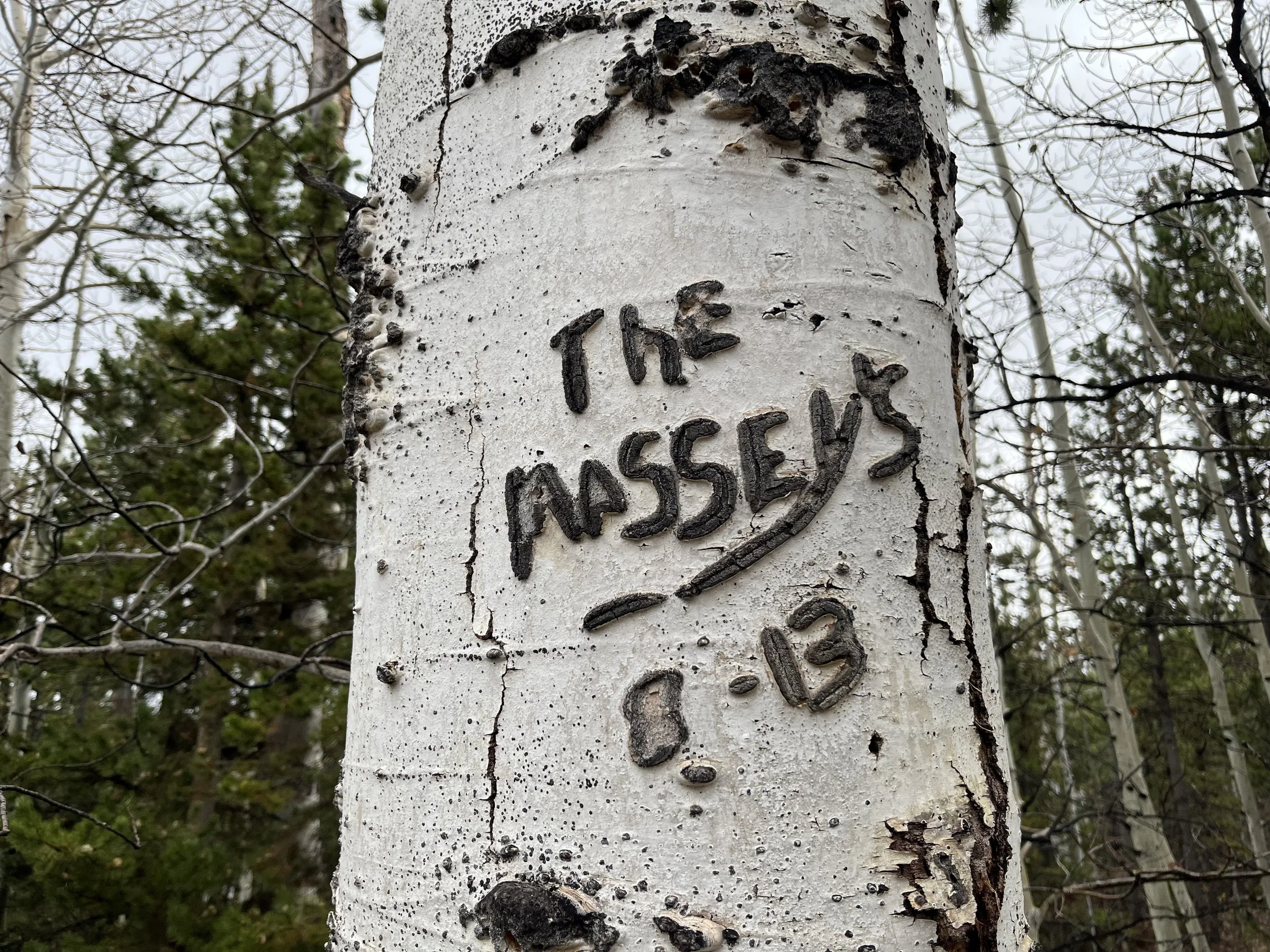
What I noticed up close were the names and initials carved into the bark. I would later learn a more technical term for this type of marking – arborglyphs. Obviously this is most prevalent close to trails, campsites, and other areas of heavy use.

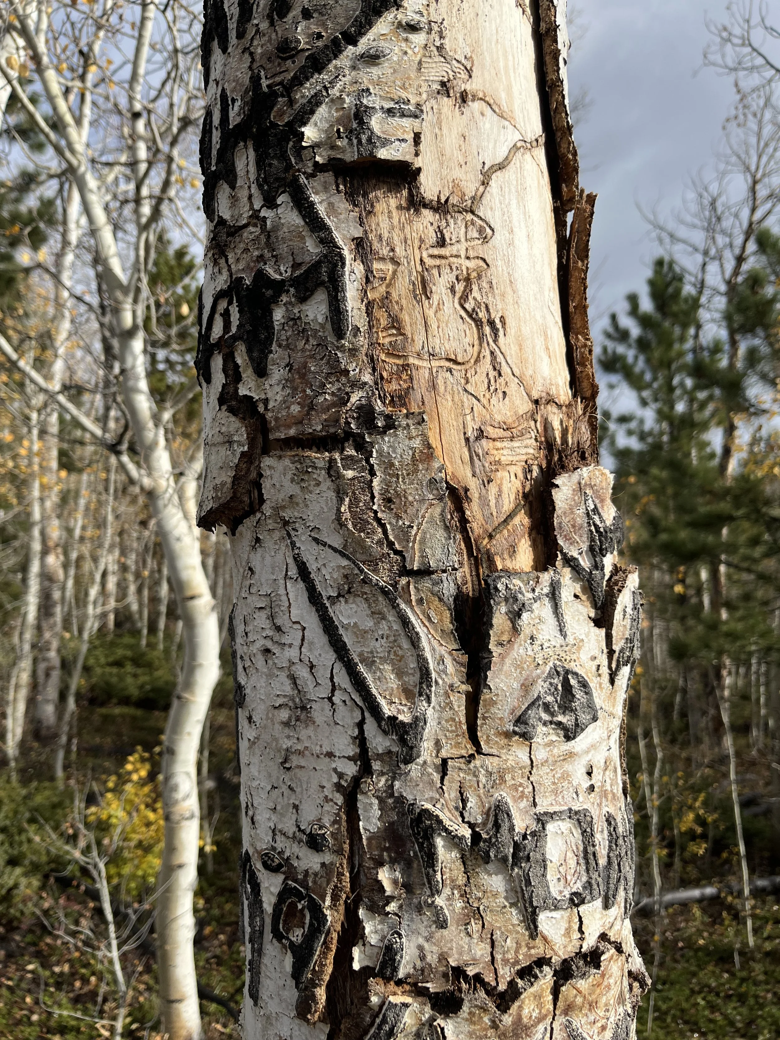
Any carving in the pristine white bark turns black as the tree heals from the damage. The raised marks almost seem to blister, creating dark, exaggerated wounds. Large trees that are prominent in the landscape seem even more likely to be marked – a better canvas, especially if they’ve been marked before. Not surprisingly, heavily marked trees are often dead or in decline. The damage really puts the tree at risk from a whole host of different pathogens. 

I am interested in exploring and speculating about what makes a particular tree attractive for this type of vandalism. And why are the marks never fully subsumed if a tree survives and persists? Learning about the chemical reaction that results in the black-on-white glyphs seems very exciting.

I can imagine harvesting flaking bark from trees that have died, and making with that material would be fascinating. It evokes a camping nostalgia; it archives a history of site use; it acknowledges and utilizes a healing process, scarification, to mark an impulsive, abbreviated human communication.  What could be built from the offage of a single, particularly prominent and deeply marked tree from an interesting locale? Would it become some kind of site beacon or memory/nostalgia post? 

Quaking aspen is a short-lived tree, averaging 100-120 years. It can show glyphs for most of its life. 

At the same time, a quaking aspen is one of the largest and possibly the oldest living organisms on earth, because of the species’ tendency to reproduce clonally from a singular root system. An entire aspen forest can be connected and considered one enormous organism. How does the physical expansiveness of these beings and the relatively short lifespan of individual clones relate to human marking of the trees? There are crazy spirals of time and scale/scope at play.

Quaking aspens in the New York landscape have the effect of evoking the West for me. Since I started to notice it a few years back, I’ve discovered that it is an early succession tree in the east. It doesn’t seem to thrive in the deeper hardwood canopy. Its relative, bigtooth aspen, does well in the newly established forests among ash, elm, and others. Recently a cluster popped up in our fallow gardens. It was removed for fear that it might quickly take over a section of the field.  

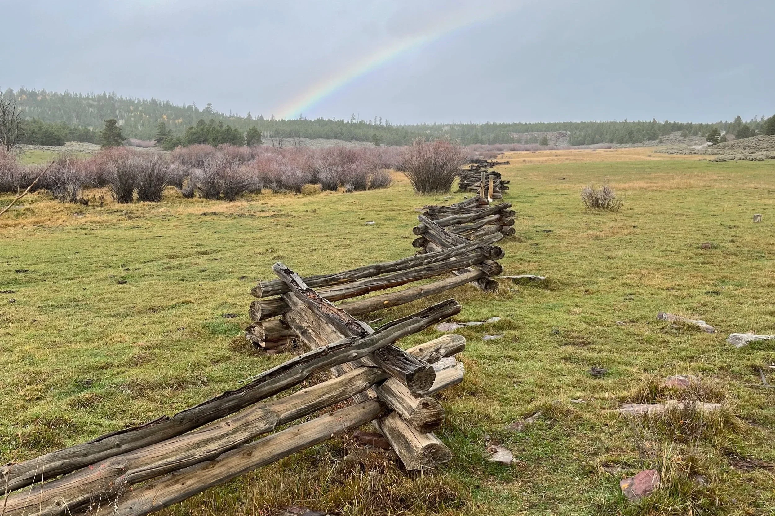
I also took note of the zigzagging log fences that run through public lands across the range. Built quickly from what I assume are the trunks of lodgepole pines, I’m guessing ranchers erect them to contain free ranging cattle in the national forest. Boundaries are established to make livestock more manageable in grazing areas.

What could be learned from dismantling a decomposing or no-longer-functional fence? Could the wood from the elevated (and thus less deteriorated) logs be dated to help us chart a chronology of occupation? How old are these fences? How long do they last? We can use the wood to tell the story of livestock impacts on mountain ecosystems. We should look closely at what emerges in contained areas.

What do these fences say about private/leased use of public lands? In one spot, I found a broken fence interrupted by a stream. This particular overgrown section climbed an embankment – a sophisticated application of a simple fencing approach. The wood investment for this type of fencing is remarkable. How many trees are required to establish a mile of fencing? How much forest is cut down to cordon off a whole area? Does this tree harvest contribute to expanded grazing lands—are fences built from what is cleared? Do cows graze aspen? Do they coppice aspen for feed in these zones?

The forest in the Northeast is a crazy patchwork of private holdings, each with its own use history and distinct variations on the larger ecosystem traits. Old stone walls are a defining feature of the landscape, evidence of deep agrarian history and a commitment to landholding permanence. Cleared fields are bounded by removed stones, which become livestock barriers. Barbed wire was prevalent in private holdings in both regions.

A property patchwork is missing from the public lands of the West. Areas of fencing are makeshift and certainly more fleeting. Do these western fences on public lands get moved/reused?

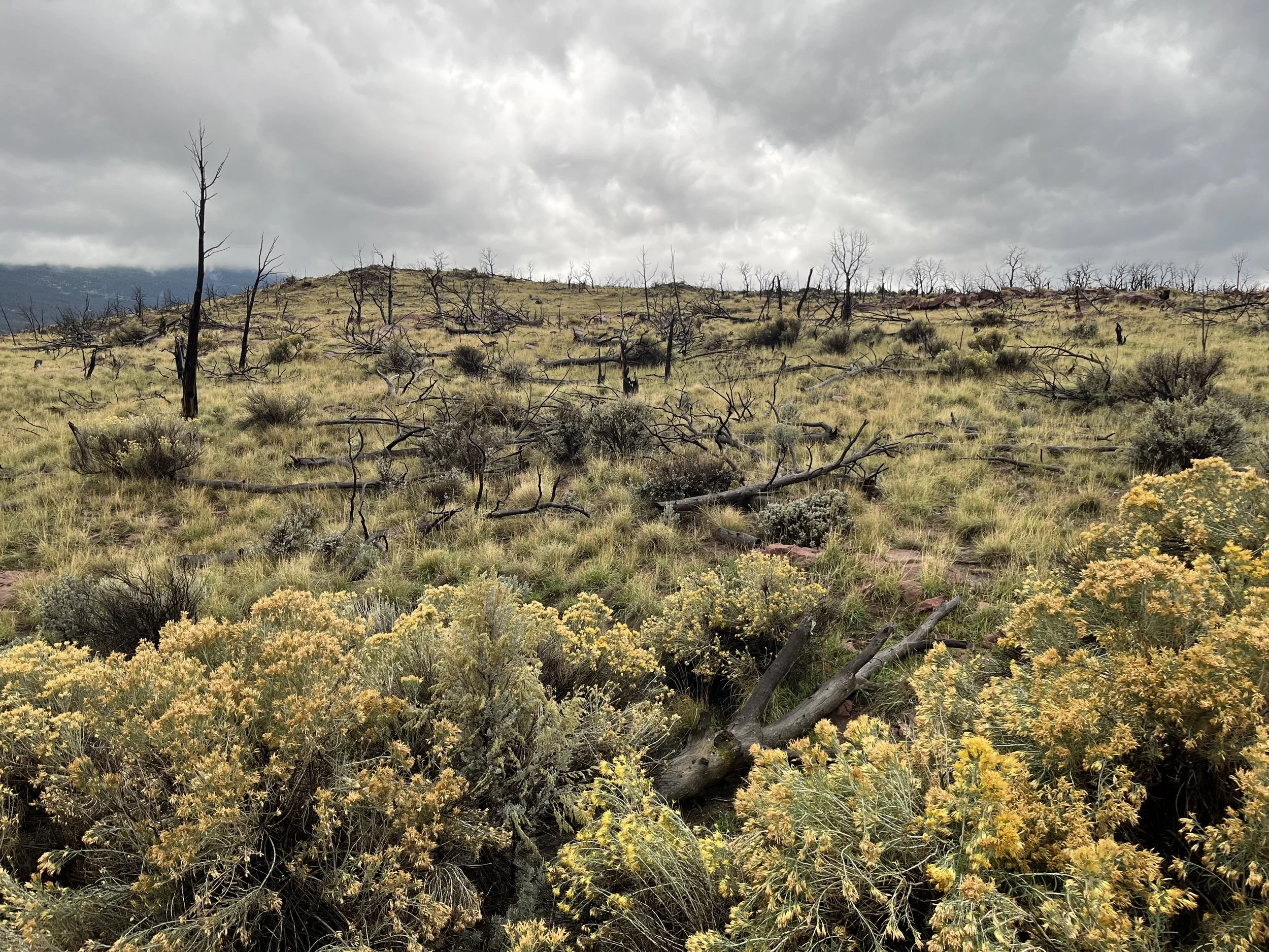
Forest fires have also made a deep impression on the landscape. I drove through Dutch John, UT, where in 2002 a fire ravaged the landscape near the Green River below Flaming Gorge reservoir. This is one of many places recovering from wildfire that decimated the tree population. This burn was so intense that very few trees survived it.

This particular fire was called the Mustang Ridge fire. The lost trees seemed to be pinyon pines and Utah juniper. How old were these trees and forests? 24 years after the burn, I saw little evidence of new trees growing in the landscape. To what degree was the soil sterilized?

The landscape is now alive with grasses and sagebrush alongside the black, skeletal trunks of charred trees. In a sense, these pines and junipers have been weatherproofed by the deep char. How long will these trunks from small-to-medium trees stay clearly visible in this terrain? How might we use this wood to tell the story of a particular type of forest fire?

I can only wonder what we will find after walking for days in this novel environment. It felt poignant that I traveled through the forest of char on a wet, rainy day.


These observations were made from just a few hours, mostly from the road. What will a much deeper look reveal about these altered trees, landscapes, ecosystems? How exciting to think about using the material of loss to become intimately familiar with the impacted species of the Uintas.

Next
Next

Plateau Mountain - High Peak #1